
A local advertisement must lead customers to a place as well as to a product. What luck, then, to be directing customers around the notably, or tediously, regular grid of Philadelphia!
But the grid quickly became cluttered. (The source here, among many discussions of the street system, is Philadelphia: A 300-Year History, edited by Russell F. Weigley [New York and London, 1982], 312, 314, 359‒60, and 375. See also Robert I. Alotta, Mermaids, Monasteries, Cherokees and Custer: The Stories behind Philadelphia Street Names [Chicago, 1990].)
The old squares had been divided, creating alleys and courts unfamiliar even to residents.


Addresses might include half-numbers.

Until 1853 there was a double system of numbering for north-south streets. Numbering began at the Schuylkill River as well as at the Delaware River, working its way toward the middle of town. The first business below was on Market a few doors east of Twentieth Street.


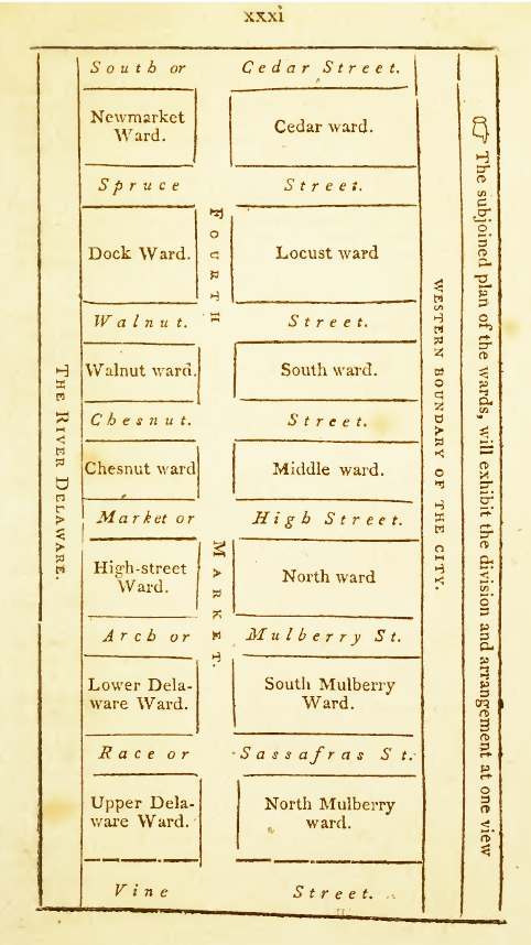
West High Street? Then why not East Walnut Street?

Parmelee and Valette’s business would have lost both parts of its address had it stayed put until 1853, when High Street formally acquired its familiar name, Market Street, around the time the markets themselves were being torn down. At the same time, familiar variants officially replaced the names of some of the city’s characteristic “tree streets.”

Thus two street names could extend simultaneously along the length of a street. In other cases, different names were used for the discontinuous segments of what we think of as one street. Alotta’s Mermaids, Monasteries, Cherokees and Custer describes the process by which, starting in 1853, such streets as American and Delancey were given a unified nomenclature (Weigley, p. 375).
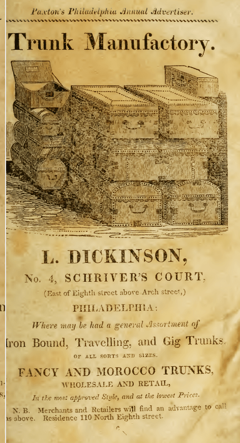
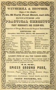
A slightly different aspect of the focus on blocks rather than streets is seen in the advertisements below. Shouldn’t an address between Seventh and Eighth have a number higher than 2? But we see in early maps, for example, the 1796 Hills map and the 1840 map of the Society for the Diffusion of Useful Knowledge, that Locust Street began under that name on the west side of Washington Square. If usage describes the haphazard development of streets, Locust is an entity that is numbered from the spot where it begins on the ground. In the present system, designed to give or prescribe a set location for every address, a street linked to the grid, like Locust, is treated as though it had the same starting point as Market and Chestnut. A similar case involves Cherry Street, which begins at Third Street on the 1840 map.


Philadelphians were dealing with more than a collection of eccentricities. Faulty street numbering affected all streets. (See Michael McLarnon, Heather Newlin, and Jason Hutchins, Avencia Incorporated, “Mapping Historic Streets: Using GIS to Track Historic Changes through Time,” chapter 8 in http://repository.upenn.edu/cml_papers/1/, and Anton Tantner, “Identifier les maisons. L’introduction du numérotage des maisons en Europe,” Histoire & mesure 24.2 [2009], also available online in English. http://histoiremesure.revues.org/3942?lang=en. These articles describe the alarming clockwise or horseshoe system of street numbering that was in place here ca. 1785.)
Fortunately, one rule has been with us since the days of the first census in 1790: numbers on the north and east sides of streets are odd, and numbers on the south and west sides are even. Because advertisers frequently specified street sides, we can see (in, for example, the notices in directories from 1818 to 1858) how faithfully this rule was followed—so faithfully that a customer might have said, tell me something I don’t know!


Now we go from the smooth to the snarled. The progression of numbers from block to block, and their relations with intersections—that is where guidance was needed. Numbers increased as they went west, or as they went north or south from Market, but they did not increase as they do today, in a regular, predictable fashion.
The problem is clear not only in advertisements but in the directories themselves. DeSilver’s Philadelphia Directory, and Stranger’s Guide for 1828 contains a “List of the several Corners of Streets in the City of Philadelphia, with their respective numbers, the more readily to find the residence of any particular individual.” The numbers it gives for, e.g., Market and Chestnut generally go along with the advertisements in the 1818‒58 directories. (It must be admitted that agreement on a designation like “between Sixth and Seventh” or “near Fifth” does not get us very far.) It is clear, though, that this list, unlike the current system, is descriptive rather than prescriptive. Some corners are keyed to numbers, others to a distillery, tavern, or waste lot. It is indeed a list rather than a system, and a list fated to go out of date with the disappearance of the distillery or tavern. Also, it displays oddities that turn up in advertisements as well.
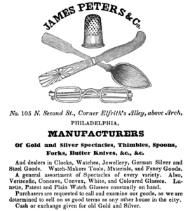
Below are sets of advertisements with street numbers that do not seem to be in accord with each other. A store is said to be “opposite” a hotel that seems, to judge by the numbers, to be half a block away. A shop at Second and Quarry, several doors north of Elfreth’s Alley, has an address lower than that of a business at Second and Elfreth’s Alley.


What was going on? The mismatched couples tend to be even and odd combinations. It seems that the numbering on one side of a street went at one pace, while the numbering on the other side went at another.
This mismatch is apparent in the 1828 list of corners. At Market and Seventh, the southwest corner is numbered 230, and the northwest corner is 271. At Market and Thirteenth, the southwest corner is numbered 400, and the northwest is 455.
Street numbers did not seem to inspire confidence. Some advertisements combine an intersection with a street number that seems to be floating or irrelevant.
It is not surprising that most of the street numbers given in advertisements in the city directories from 1818 to 1858 are annotated in some way.
The most common hints involve cross streets.


Some businesses, presumably at intersections, gave two (old-style) addresses rather than one.

Some businesses used signage to stand out on the street. I wonder what became of the mammoth shirt collar.


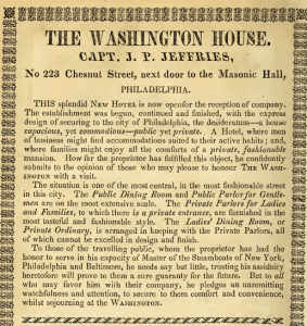
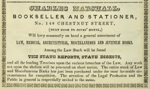
Less prominent businesses hitched themselves to landmarks or to the signs of better-known businesses.


Thomas Whitney was wise to establish downtown points of contact for his isolated business, in case the mill pond was hard to find.

Fortunately, the consolidation of the city in 1854 led to a general regularization of the street system. At last, in 1856, a city ordinance, to go into effect in January 1857, brought to the streets the current system of numbering by hundreds, block by block.
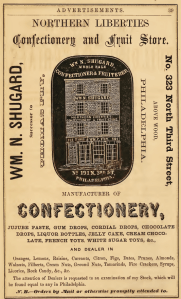
The transition must have been messy. The advertisements in McElroy’s Philadelphia City Directory for 1857 and 1858 are a mixture of old, new, and old and new combined. The fancy goods house and confectionery combined images featuring the old numbers with copy featuring the new numbers.


Some merchants, rather than giving two addresses, reminded customers that they remained “at the old stand” despite the change in numbering.

Even when the system began to take hold, merchants continued to key addresses to corners. Corner keys would, after all, continue to be useful wherever addresses on north-south streets were far from Market Street.


Some continued to give street-sides as well, telling customers two things they already knew.

Now we all rely on a simple system—wherever we are governed by the grid.
Please see also You Must Take the Red Car
Navigation Continued: “Marks and Numbers of Streets,” from the Philadelphia PUBLIC LEDGER, 1836

On my various visits to England I always remember friends and relatives giving me directions to their homes by the use of landmarks. Turn left at the post box, turn right at the big oak, etc. No street names or numbers were ever employed in the directions. I had forgotten about this phenomenon until visiting England again in May. Directions still consisted of walk to the roundabout, take the street closest to the pub, turn left at the auto repair…. etc. This alleviates the necessity of street names and numbering making any kind of sense! As always, a very well researched and presented article!
LikeLike
Not that the Forest of Arden was in England or was set up with streets, or that you remember the days of Shakespeare–but your comment reminds me of Celia telling Oliver how to find her sheep-cote in AS YOU LIKE IT, Such directions are confusing to people used to the grid system that Dickens so disliked. There is usually a numbered street nearby, to help with bearings. Perhaps someone should pose as a tourist to see how often landmarks are given.
LikeLike